Floating Dock Site Survey: The Data You Need to Prepare from the Start
A guide to floating dock site surveys: water data, bottom conditions, logistics access, and the permits and coordination to prepare before a project starts.
Imagine the pontoon units have arrived on site, but the truck cannot get close to the water's edge because the road is too narrow. Or the dock has been installed, only to find that the mooring lines are too short when the water level rises in the rainy season. Problems like these can usually be prevented with one simple step: a floating dock site survey before the design is finalized.
This guide summarizes the data that generally needs to be collected, from water conditions to coordination with relevant parties. The list is general; every site may of course require additional data.
Why a Survey Determines Project Success
Modular floating structures are flexible, but that flexibility still requires data. The number of units, the layout, the frame type, and the mooring system all depend on actual field conditions.
A good floating dock site survey helps the technical team develop a suitable design, estimate material requirements, and plan the sequence of work on site. Without adequate data, dock planning tends to rely on assumptions that risk being off the mark.
Water Data to Collect
Water data is the foundation of all planning. Some of the key information generally required:
Depth and water level changes
Record the depth at several points of the planned dock, not just at one point. In addition, understand the range of water level changes, whether due to tides at sea or differences between the rainy and dry seasons in lakes, reservoirs, or rivers. This range affects the length of the mooring lines and the design of access from land.
Currents, waves, and wind
In general, waters with strong currents or high waves require a more carefully designed mooring system. The prevailing wind direction is also important, as it affects the position of the dock and the direction boats take when berthing. If possible, observe conditions at different times, including during less favorable weather.
Bottom conditions and mooring system
The type of bottom, such as mud, sand, gravel, or rock, determines the choice of anchors and the method used to hold the dock in place. Muddy and rocky bottoms generally require different approaches.
Also check for objects on the bottom, such as logs, building debris, or pipes. These objects can interfere with anchor installation and need to be identified early. In a floating dock site survey, this information is usually supplemented with photos or position notes so the technical team can easily follow up.
Land Access and Material Logistics
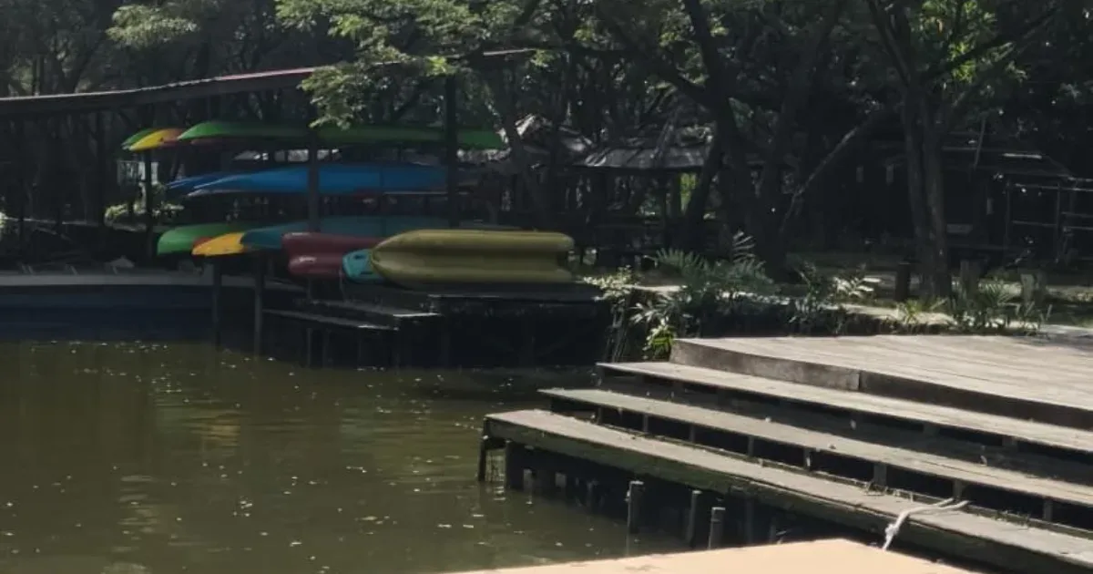
This aspect is often overlooked, even though it largely determines how smoothly installation goes. Questions to answer include: how close can vehicles get to the water's edge, where are the loading/unloading and assembly areas, and how will the units be lowered into the water.
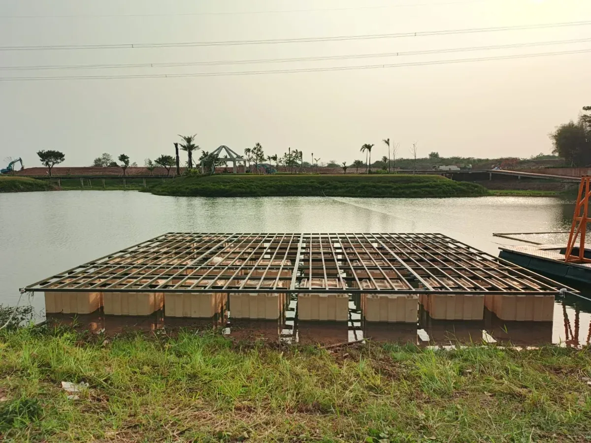
Frame installation on pontoons at a floating dock project in Serpong, Banten. Source: Bajau Indo documentation
A modular system offers advantages in terms of logistics access. According to the official specifications, one Block Pod unit weighs 40 kg and one Nusa Dock unit 32 kg, so units can be moved in stages and assembled on site. Even so, the delivery route, temporary storage area, and assembly location still need to be planned. That is why a floating dock site survey should also cover the route from the main road to the point where units are launched into the water.
Permits and Coordination with Relevant Parties
Every site has different regulations. In general, construction on the water may involve the local government, area managers, agencies responsible for waterways or transportation, and the surrounding community. Project preparation should include checking permit requirements early on so the schedule is not delayed.
Coordination with other water users, such as fishermen or boat operators, is also important so that the dock does not obstruct existing routes.
Quick Site Survey Checklist
Use the following table as an initial checklist before the floating dock site survey is carried out together with the technical team:
Water — Data to collect: Depth at several points, range of water level changes, currents, waves, wind
Bottom — Data to collect: Bottom type, presence of objects or obstacles
Land access — Data to collect: Road width, vehicle distance to the water's edge, loading/unloading area
Logistics — Data to collect: Temporary storage area, assembly location, method for lowering units into the water
Function — Data to collect: Type and size of boats, estimated number of users, facility requirements
Permits — Data to collect: Relevant agencies, area managers, coordination with residents
Once the data has been collected, you can create an initial sketch using the Bajau Indo Drawing Tool. For platforms based on Nose Pods and Body Pods, there is also a pontoon platform configurator that shows a preliminary estimate of the number of units and buoyancy, with the note that the results will be verified by the engineering team. An overview of the benefits of floating docks in general can also be found in the article why floating docks are key to port flexibility.
Frequently Asked Questions
Who should carry out a floating dock site survey?
The project owner can collect initial data such as photos, videos, and road access information. For more technical measurements, such as depth and bottom conditions, it is best to involve experts or an experienced technical team.
Is a survey still needed for a small floating dock?
Yes. A small size does not eliminate the need for data on water level changes, bottom conditions, and site access. This data still determines the mooring system, layout, and how the units are delivered.
What data can I send first for an initial consultation?
Send photos and videos of the site, the approximate size of the area, the approximate water depth, information on water level changes, and the condition of road access to the water's edge. This initial data helps the team build a picture of the requirements before a technical survey is carried out.
Already collected some site data? Send your photos, videos, and notes via WhatsApp 0878-5931-4314 or email marketing@bajauindo.com. The Bajau Indo team can help review that initial data and suggest any additional information still needed.
Written by
Tim Redaksi Bajau Indo
Tim Teknis & Redaksi
Tim teknis dan redaksi Bajau Indo — produsen dermaga apung, kubus apung, dan ponton modular LLDPE dari Sentul, Bogor.
Tags
Share this article: